Posts

Showing posts from 2011

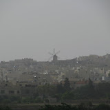
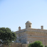
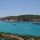
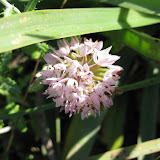
2011-11-27 M'Scala / San Anard / Bidni

Image
Marsaskala is a small and picturesque fishing village in the south-eastern region of Malta, situated within a deep inlet. The sea front is a lovely place for a stroll, to gaze at the fishing boats which crowd the bay. Tourists and locals alike may enjoy a pleasant walk on the promenade where most of the bars, restaurants and cafes can be found. Natural attractions like the rocky shores near Zonqor Point add character to this growing village which now has a population of more than 8,000 inhabitants. (Source: Marsascala LC) Enjoy the photos.

2011-06-05 Kirkop to Ta’ Kandja

Image
Check out the geotagged photos, gps trail and stats of this walk. Photos of the Libjan jets held in Malta as well as the the sites that surround the area.

2011-05-15 08:59 Mdina-Mtarfa

Image
Enjoy!

2011-05-01: Comino

Image
This walk was organised by the Malta Council for the Culture and the Arts. During this walk we visited the tower, the now abandoned bakery, St Maria Battery, the hospital and the small chapel. Mr Neville Ebejer was our guide for the tour. Click the photo below to view the rest of the album with information on where the photo was taken.

2011-04-03 Burmarrad - Wied Qannotta - Wardija Ridge

Image
  This is a circular scenic walk around Wied Qannotta with breathtaking views of Xemxija bay from Wardija Ridge. (Click above to view other photos). Rating: Moderate with some inclines Starting / Ending Place: Scotts Supermarket car park, Burmarrad

2011-03-27 Ghajn-Tuffieha and Gnejna

Image

2011-03-20 Balluta Bay - White Rocks - Pembroke

Image